The plaques
Celeron buried six plaques on the expedition, including one here that’s never been found
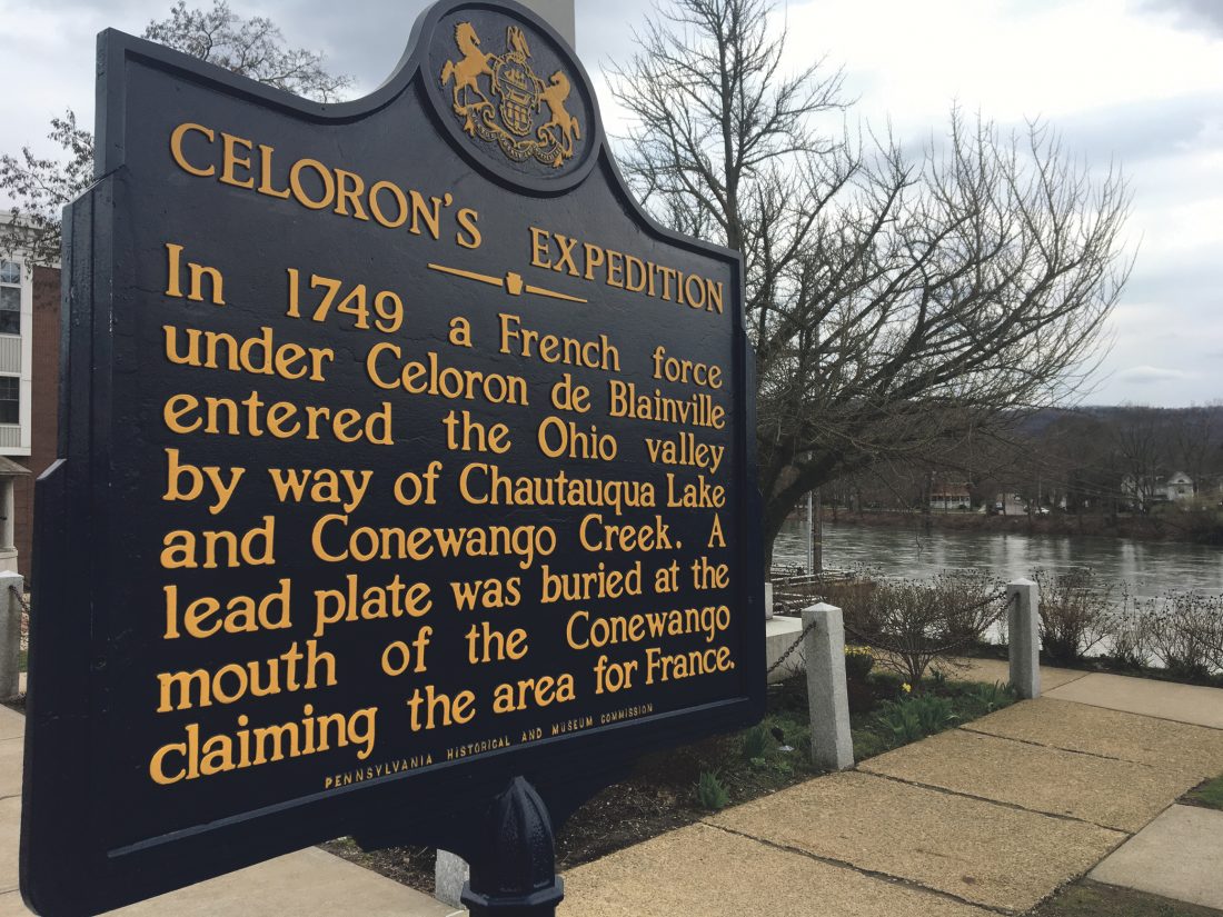
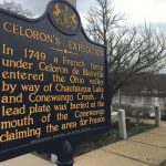
The Pa. State Historical Marker located in Soldiers and Sailors Park in downtown Warren.
-
- The Pa. State Historical Marker located in Soldiers and Sailors Park in downtown Warren.
-
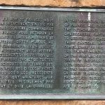
- Times Observer photo by Josh Cotton/photo from americanantiquarian.org Above, the reproduction plate on the front of a stone at Heritage Park in Warren. This looks similar to the one found in West Virginia. Below, the Pa. State Historical Marker located in Soldiers and Sailors Park in downtown Warren.
Here’s the short form: Celeron buried six plaques at the mouths of waterways on his expedition. Two of the six have been found. One was found on the Muskingum River in 1798 and is owned by the American Antiquarian Society in Massachusetts. Another was found in Point Pleasant, West Virginia.
According to an unidentified newspaper article on the subject in the archive of the WCHS, six plates were buried at the mouths of the Conewango, the Great Kanawha, the Great Miami, Wheeling Creek, the Muskingum River and at Indian God Rock near Franklin.
Only two of the six have been found.
So where are the other four? There are a surprising number of theories in answer to that question.
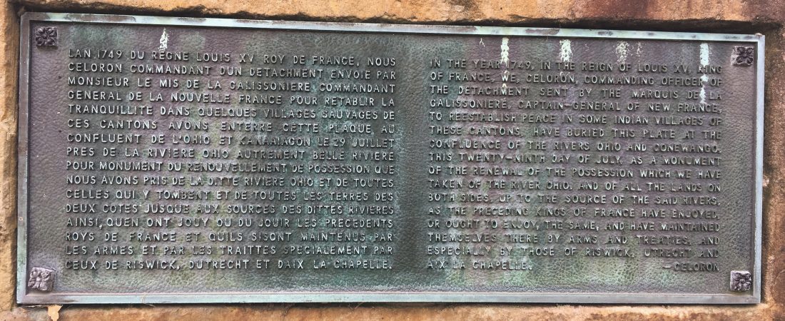
Times Observer photo by Josh Cotton/photo from americanantiquarian.org Above, the reproduction plate on the front of a stone at Heritage Park in Warren. This looks similar to the one found in West Virginia. Below, the Pa. State Historical Marker located in Soldiers and Sailors Park in downtown Warren.
A Warren Times-Mirror article on the subject reports that the ceremony at the confluence of the Allegheny and Conewango “is described thus. ‘At the foot of red oak on the south bank of the Ohio River (Editor’s note: This is the Allegheny. The French didn’t know the difference), and opposite the point of a small island at the foncluenfe of the two rivers, Ohio and Kanaougon. At the time the plate was interred all the officers and men were drawn up in battle array, and the chief in command proclaimed in a loud voice, ‘Vive le rou,’ and announced that possession was taken of the country in the name of the King of France, the royal arms being affixed to a neighboring tree.'”
Celeron’s journal affirms that basic narrative.
The plaque’s inscription read as follows: IN the year 1749, in the reign of Louis the XV, King of France, we, Celeron, commander of the detachment sent by the Marquis de la Galissionaire, Captain General of New France, to reestablish peace in some Indian villages of these Cantons, have buried these plates at the confluence of the Rivers Ohio and Kanaougan, this twenty-ninth day of July, as a monument of the renewal of the possession which we have taken of the River Ohio, and of all the lands on both sides, up to the source of the said rivers, as the preceding Kings of France have enjoyed or ought to enjoy, the same and have maintained themselves thereby arms and treaties, and especially those of Riswick, Utrecht and Aix La Chapelle.”
Miller writes that the plaque was 7 1/2 x 11 x 1/8 inches in size and speculates that “Indians saw the French bury it ‘midst considerate pomp and ceremony,’ it would serve little purpose beneath the ground. If the French really expected it to stay buried there they were seemingly immature or stupid; on the other hand, if they planted it with the definite expectation that it would be dug up, they were touched with the mark of genius.”
So there’s theory number one – that it was dug up.
Miller speculated that if the “Indians didn’t promptly dig it up, and maybe melted it down for bullets, then the chances are it stayed buried until the spring of 1827 when the river was exceptionally high and the ice thick. That year, the great red oak tree selected by Celeron was torn up by its roots and laid in the river for a year or two until a later flood carried it away.”
Community

Dance Express has successful finale
Briefs
Allegheny Outdoor Club to kayak Sunday On Sunday, June 7, members of the Allegheny Outdoor Club will kayak on the ...
Another major donation

‘… A Very Devastating Disease’
Youngsville Life: Youngsville High School alumni lunch scheduled
Please email community news to Colette Nelson at Colettenel.ypl@gmail.com by Wednesday of each week to be included ...