County might see rain from ‘Ida,’ but remnants to hit elsewhere
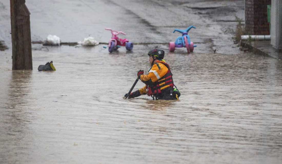
AP photo A member of a rescue team walks through a flooded street in Bridgeville, Pa. Pennsylvanians braced for downpours and high winds from the remnants of Hurricane Ida, though that impact was expected to be minimal locally.
Pennsylvania is prepping for additional impacts from the remnants of Hurricane Ida.
Warren County is not in the impact zone.
Gov. Wolf warned Pennsylvanians to stay home and stay safe, saying urban, river and flash flooding were expected through Thursday, according to the Associated Press.
The National Weather Service has issued flash flood warnings and flood watches for a large portion of the state. The counties in that zone create a line from the southwestern part of the state to the northeastern and do not include Warren County nor its immediate neighbors.
“It looks like the main slug of rain association with the storm is generally south of Interstate-80,” National Weather Service Meteorologist Aaron Tyburski said Wednesday. “There is a sharp drop off in precipitation” to the north.
Tyburski said the southeastern portion of Warren County might get some rain that is associated with the storm, but not much.
There will be another impact of Ida felt locally.
“The one effect we will all get from the storm … is cooler air pulled down from Canada,” he said. Ida is acting as a “big pattern-change instrument.”
Rain in the forecast for the weekend is “not associated with any tropical system,” he said, but it is a result of the pattern change.
The stretch of hot, humid weather will end.
“We’re going to see temperatures cool down over the weekend,” Tyburski said.
STATEWIDE IMPACTS
The National Weather Service warned the highest risk of flooding extended hundreds of miles along the border with Maryland and northward into the mountainous area south of State College. The Susquehanna River was projected to crest sometime Thursday, and a minor tornado threat was posted.
PennDOT said more than 50 roads were already closed by late morning Wednesday as the system arrived in the western part of the state. Boats were needed to rescue students after a school bus became stuck in high water in the Pittsburgh area.
Randy Padfield, the state’s emergency agency director, said the rain falling on already wet soil along with high winds and trees top-heavy with leaves increased the chances that power may go out.
Innumerable schools, businesses and other institutions shut down or had plans to close early in the greater Harrisburg region, where more than 5 inches of rain was expected before high winds were to arrive later in the day.
Wolf late Tuesday issued a disaster emergency that put teams in place to respond to the storm and its aftermath.
Some 120 National Guard troops were activated to help operate about three dozen high-clearance, high-water vehicles that can perform evacuations. Guard members were also put on duty as part of the state’s helicopter aquatic rescue team.
Around-the-clock operation of the state’s Commonwealth Response Coordination Center began Wednesday morning.
The Associated Press contributed to this story.
Local News
Daytime closures start on Page Hollow Road
Page Hollow Road (Route 4009) in Freehold, Pittsfield and Sugar Grove townships, Warren County will be closed to ...

United Fund successfully completes 101st campaign

Women’s Club hosts last luncheon of season
City woman charged with theft of cell phone
A Warren woman was jailed on $25,000 bail after being charged with third-degree felony burglary on Friday after ...

Quilters Night Out to host show Saturday, Sunday