
Officials to keep eye on flood-prone areas
Trending
Temperatures in the 50s are on the way.
But, with a foot of snow still hanging around parts of the county, that's not all good news.
The forecast from the National Weather Service is calling for a high near 52 today and near 56 on Thursday. The low tonight is expected to be around 44.
There is a chance of rain tonight, then a 100 percent change of rain -- up to one half inch, on Thursday.
Ten inches of melting snow turns into about one inch of water.
For some parts of the region, those factors add up to hazardous weather advisories and flood watches.
The National Weather Service has issued flood watches through late Thursday night for Erie and Crawford counties, and Chautauqua and Cattaraugus counties in New York.
Both Forest and Venango counties are under hazardous weather outlooks -- "There is a potential for heavy rain Thursday into early Friday. Isolated areas may experience flooding."
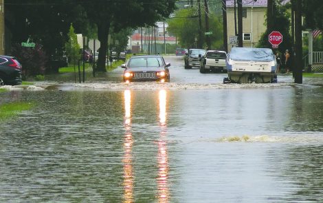
Although the NWS has not issued those warnings for Warren County, county officials are keeping an eye out.
"There certainly could be some flooding in our 'normal' flood-prone areas," Public Safety Director Ken McCorrison said. "We will be monitoring the situation. We usually see hazardous outlook products prior to an event. I have not seen any yet."
The forecast calls for a return to temperatures in the 20s on Friday and Saturday.