Local surveyor David See has five-decade history behind the scenes of Warren County projects
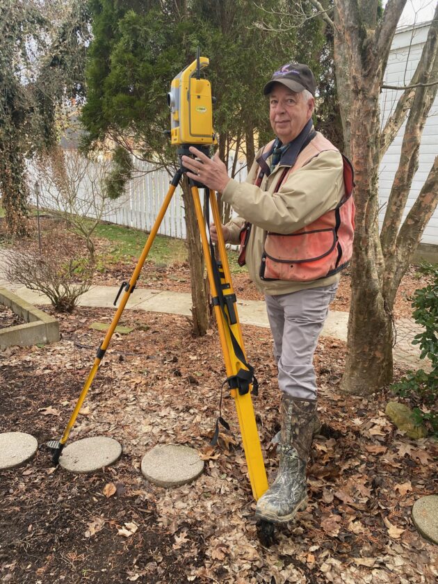
Pictured is David See setting up a Trimble Robotic Instrument for a location survey.
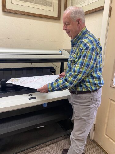
David See reviewing a plan just plotted on a Large Format Design Jet Plotter
Land surveying is the science of measuring land and mapping it using coordinate systems to determine exact positions and elevations. From establishing property boundaries to supporting construction, engineering projects and infrastructure development, surveyors help ensure that the places we live, work and travel are accurately measured and responsibly built.
For more than five decades, David See has helped shape the physical and economic landscape of Warren County and the surrounding region. As the owner of David See Surveyors LLC, he has worked with property owners, attorneys, real estate professionals, municipalities, engineers and developers to better understand and define land.
“Land surveying is important to build a community,” See said.
His work can be seen throughout the city, including involvement in the Impact Warren development project, downtown improvements at Soldiers and Sailors Park and site layouts for banks, parking structures and public spaces. Though often behind the scenes, surveying plays a critical role in projects both large and small.
“We’re classified as expert measurers. We put it all together,” See said.
Since he began his career in the early 1970s, the profession has undergone significant technological change. What once relied on steel tapes, compasses and handwritten field notes has evolved into the use of survey-grade GPS systems, robotic total stations and laser scanning.
“Back then, you needed two people just to measure distance,” See said. “Now I can do hundreds of points a day by myself with a robotic system.”
After graduating high school in 1970, See studied drafting and design technology in Pittsburgh before beginning a career as an electrical draftsman. A job opportunity with a major engineering firm introduced him into photogrammetry and eventually led him into field surveying. One of his earliest assignments took him to the Shippingport Nuclear power plant, which was the world’s first of its kind.
“I just loved it. I have a passion for it and that’s why I’m still working today,” said See.
Despite the outdoor nature often associated with the job, surveying is largely analytical and research-driven. See estimates only about 25% of the work takes place in the field, while the majority involves studying property records, analyzing data and producing maps and legal descriptions.
“You have to be an analytical thinker,” See said. “It takes a certain person to do this job.”
Today, the profession is facing a growing demand for new surveyors as many experienced professionals approach retirement.
“There’s a shortage of surveyors right now,” See said. “Not many young people are getting into it.”
He encourages students interested in the field to focus on math and to gain hands-on experience working alongside established surveyors. Becoming licensed requires years of training, supervised experience and passing rigorous exams.
“It’s not easy, but it’s rewarding,” See said.
While surveyors rarely see the finished results of their work in the same way builders or architects do, their contributions are foundational.
“You don’t step back at the end of the day and see a house you built,” See said. “But every day is a challenge, and that’s what keeps it interesting.”
Local News
Community Foundation of Warren County receives contributions, grants
The Community Foundation of Warren County received $15,060.90 in contributions from donors in February to the ...

Local surveyor David See has five-decade history behind the scenes of Warren County projects
Webster named to Buffalo Broadcasters’ HOF
Many states may not be able to count mail ballots that arrive after Election Day
Warren County Commissioners increase hotel tax fees
The Warren County Commissioners have amended the county’s hotel tax ordinance. Treasurer Lisa Barr presented ...
JCC notes enrollment increase for spring
Enrollment at SUNY Jamestown Community College continues to climb this spring semester. Total headcount rose in ...